
From Helgoland and back via wad and wantide
On july 25th I start off from Helgoland with my return journey to Holland. Because of the COVID-19 pandemic I decided not to sail any further than the German Isle Helgoland, in the German bight and to add a new experience by going partly behind the wad isles and over the wantide. The Asmara cannot run dry.
The main reason for trying this out is because the weather, wind and wave are always coming from W – NW making the waves high and from the side, although with my sails set it is somewhat less inconvient, but the Asmara is only a converted motorboat to a motorsailor, that does not sail. Never the less, the German Bight is after the Gulf of Bicaje an aera to respect. So In the year 10 year that I start and finish in this region 9 out of 10 I have waves from 2,5 mtrs or more. I got fed up with this phenomena.
On the route to the Netherlands I pass several German and Dutch wad isles. At first I was thinking of going behind the first Island I pass from Helgoland, “Wangerooge”. But because the weather on sea was ok this time (what it’s usually not) I set sail from Helgoland after taking 800 ltrs of tax free diesel round 10.00AM. Because of the weather this time I decided not to take my opportunities and set sail for Norderney first and there go behind the first Isle “Juist” towards “Memmert” and “Borkum”. Genua and main sails are set. The first part is open sea but fairly reasonable waves of around 2 mtrs. Heading South first and upon reaching the shipping lanes to Hamburg and crossing them and turn West towards Norderney, thereby passing Wangerooge, Spiekeroog, Langeoog and Baltrum.
Wantide defenition
The wantide is a dry falling route at low tide between the Isle and the main land. The whole wantide route runs beteen two tidal streams points with standing water at low tide. Most of the time 1/3 of the whole route. The regular green and red bouys and at that point and are replaced by so called “prikken”. These prikken are often tree branches marking the route. Also sometimes they use wooden poles. At low tide this route falls dry, but is less in height compared to its surroundings. At high tide this route is to be followed closely to gain optimum depth and meandered thru the wad. A plate or a stream can fall dry 1 meter or less 30 cm, this last figure gives optimum depth at high tide.
Continue. . .
Around 19.30 I turn into the bouyline from Norderney in the passage between Norderney and the Isle of Juist. Somewhere on the south corner I found the end of the tidal stream behind the Island and the beginning of the wantide. I marked this position on my plotter before as a good anker place, because at low tide the will be 2,5 meter of water standing. AT this moment the water is falling already and I have to pass a shallow area before I get there. But I get across that part just in time to reach the deeper part. I drop my anker at 21.30. The tide difference between high and low is 3 meter. To calculate for my chain length 2,5 + 3 meter gives 5,5 meter at high tide times 3 is is around 15 mtr, to be safe I let 20 meter of chain down. At the firs picture you see my anker place just right from the white cursor cross, the black lines are my track I sailed.
Chart Legenda
The Isles have a white, yellow or dark green color. Left is the Isle of Juist and right the Isle of Norderney. Blue is water and remains standing water at low tide. Light green is the part of water that falls dry. Red are the bouys where alway water is. Black bouys are the so called prikken, where no water is at low tide. So now I can use a drink.

Calculation of when to go across the wantide is made of the length of it. You always want to cross this part with rising water if depth allow this, in case you ground you just have to wait some time to continue. If you ground with falling water things only get worse with time. The next day I leave about an hour earlier as planned 13.30, because the wind is increasing 6 bft at my anker spot and in combination with the incoming current not comfortable anymore. When I hoist up my anker (electrical), it remains unnoticed to me that something is happening there. Around my anker stem is an inflatable white tube, which sits between the anker and the hull. I did’nt notice at that time not see that anymore. I now sail towards the wantide, there should be around 2 meter water, my ship measures 1.25 meter, so I have about 75 cm (rising) to cross that wantide. When I pass the last red bouy, the prikken are coming in their place, I have to keep them to my Starboard side and close by. After an hour I reach the counter stream with the red bouy again and the water is getting deeper. My first wantide passage is a succes. Now I pas the rest of tje Isle of Juist towards my next anker spot at the Isle of Memmert/Borkum. The entrance of that wantide is already marked in my plotter, where to drop my anker to wait for the next crossing. I should sail to that point where a marked a spot wit 4 meter water at low tide. The water is falling now. The weather make it more difficult because the wind does not get below 7 bft anymore. Although there are some short waves but not compared to what I should have had this time at open sea, I’ll bet they are 3-4 meter.

Around 17.00 I get close to my anker spot, that is in front of the wantide. Wind stil 7 Bft. It is falling water. I sail te boat to my anker position straight on the 4 meter spot en lower my anker, that is I thought I did. I hear the motor running but don’t here the chain rumble, it looks as if the ankermotor is running free. I’ll go outside to the front deck and see a pile of chain scattered over the deck, but the anker still in its up position. What the heck is going on here. Looking over the side I see my anker being up. Looking closer to the anker chain tube I see something white in there. Closer examination learns the the inflatable tube is by force pulled into the anker chain tube. I try with a hammer to free the anker, but its completely stuck there. Due to strong wind my boat is drifting dangerously toward the shallow area, so I rush inside and put the boat in the 4 meter area again pointing back from where I came, set the autopilot on and with idle trust she continues her way, giving me some time to do something about this problem. As a last resort I get my depth beam from 5 meter to try to bounce the anker loose, in that excercise I almost fall overboard. This is crazy. I stow the beam and start thinking.
Now what, there is no harbour in the near area, the water is falling. I study the map on my plotter to look for solutions. Two options remain; going out on the open sea and sail around the Isle, with wind 7 Bft and high waves or try to make it across this wantide witch I did not plan. The length of the wantide is 1,5 mile. The water is falling, how much water falls in one hour. I have made my decision, I am going across the wantide. I turn the boat toward the wantide, give full power and with 7 kts and 1,5 opposite current I speed over this wantide. The beginning was fair, one meter water below my keel. If I ground at this speed I sure I’ve had it. I the mean time I rush with high speed meandering along all of the “prikken” the adrenaline is pumping thru my body, will I make it? The I see my depth indicator decreasing 30 cm under the keel. No!! I don’t want to finish here. Do I see a regular bouy in the distance, yes. After a what seems like an hours journey I pass the first red bouy and see the depth increasing, SAVED!!! I made it!. I follow the bouy line towards te harbour of Borkum, prepare for approach by hanging out all fenders and mooring lines. 18.19 I moore alongside a Dutch sailing yacht.

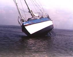
What did I do wrong? Actually nothing, only I overlooked the fact that the inflatable tube was no there anymore. If I noticed it when I raised my anker I could have gone into the Norderney harbour. Evaluating I can say that going behind the Isles over the wantide is a good method to avoid heavy seas when going over the open sea. I found it nice to do, although I had all the elements against me, making it more difficult. So it can only be better next time. And who nows may be I am going to find out If I can make stabilizers at the rear of my hull so I can run dry on the wantide. I looks relaxing to me if your on an a bank, can wander around a bit, clean the hull etc.
The next morning I leave about 12.00 to use the incoming tide to sail to Groningen where my daughter has the coffe ready. There I will see how to free the anker again.


